Over it: Gisborne’s big wet
The rain continues to fall in the Gisborne region and Louise Savage is just one of many who’s had enough.
THE BIG WET IN THE GISBORNE district has unfortunately not let up at all. Before and between cyclones Hale and Gabrielle the rain continued to fall and has scarcely let up since.
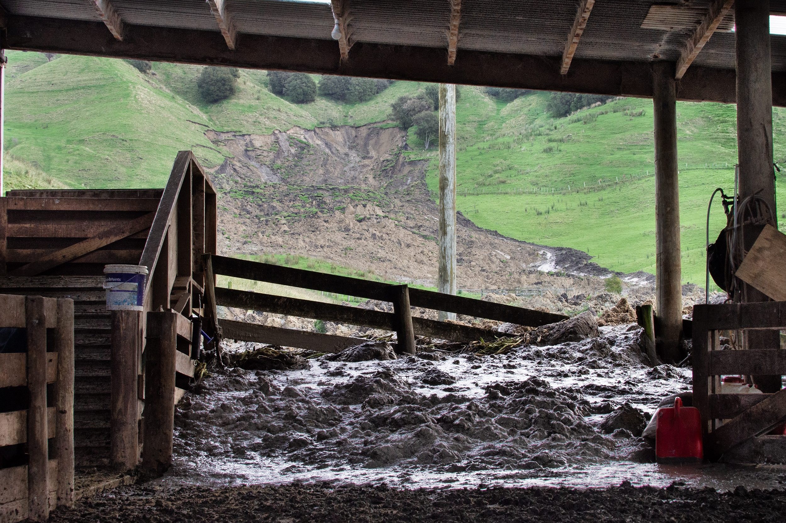
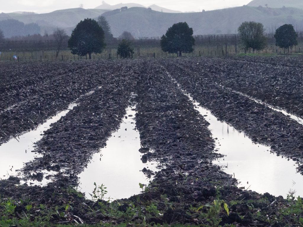
Laura Watson who farms at Waimata Valley 30km inland from Gisborne has tipped 2.1 metres out of the rain gauge already, only halfway through the year. Average annual rainfall is 1500mm. The Waimata catchment alone has suffered 10,000 landslides. There will be many more.
Principal scientist at Gisborne District Council Dr Murry Cave describes the integrity of the soil all over the district as “sloppy porridge”. He isn’t expecting the soil to dry out until next summer; after all we are at the beginning of winter.
“We haven’t even finished cleaning up after Hale, let alone Gabrielle, and the damage is just accumulating and ongoing.”
The water table is at or even above the surface all over the district, meaning the soil has no capacity to absorb any more water whatsoever. Landslides continue all over, including in Gisborne city. Several houses have been added to the tally of those already red-stickered following Cyclone Gabrielle.
Residents have been asked to be keenly aware of their surroundings, including sticking doors in buildings and hearing unusual noises, which may be a precursor to land movement around their properties. This advice is unnerving for a community already living on edge.
There are several significant groundwater aquifers beneath the Poverty Bay flats. These porous geological structures can absorb and store water.
They often comprise ancient, buried river gravels, deposited when rivers meandered over flood plains in pre-human times, before we attempted to control them and confine them to flood-control schemes.
Along with the (normally) benign climate and class I soils, this reliable water supply is a factor in the wonderful growing conditions in Gisborne for crops, from kiwifruit to salad greens, squash and tomatoes.
There are more than 1400 bores on the Poverty Bay flats, and in typical, hot, dry Gisborne summers plenty of water is drawn for irrigation and domestic use.
This hasn’t happened at all in 2022-2023. Because of the enormous volume of rain that’s fallen, there was no irrigation, no draw-down in aquifer levels, and groundwater is above the surface in some places.
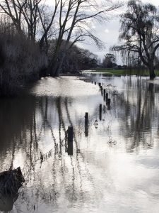
I live atop Te Hapara sands aquifer. Weirdly, the weight of rain falling all over the flats seems to push water up out of the ground. Sometimes 20mm in my rain gauge translates to a crystal clear “lake” up to 150mm deep coming up out of the ground. This phenomenon has never happened in the time the council has monitored ground water, or in fact in the 53 years since my house was built.
Normally it takes up to five months for water levels in the Te Hapara sands aquifer to recede a metre lower in the aquifer. That’s if no significant rain falls. That is extremely unlikely given we are coming into winter, meaning for many months to come we will have high groundwater levels and surface flooding every time it rains even a little.
The Gisborne cemetery is also on Te Hapara sands aquifer. There haven’t been any burials for many months. I was told many years ago that if looking to buy a property, choose one on the same soil type as your local cemetery, as that’s a guarantee of the freest-draining soil around.
Yeah right.