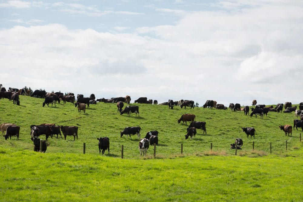
Each region is developing its own distinctive set of rules on water and its quality. Resource engineer Keri Johnston reports on what’s been developed so far.
Regionally, the development and implementation of rules relating to water quantity and water quality are moving at different paces and are all at different stages in the process. Below is an overview of where some of the larger regions are currently at.
You will note as you read this that each region has been unique in its approach to rule-setting. Some would argue this is because each region is unique and has its own issues (and I don’t disagree), but perhaps the scale of the disparity we are seeing is not needed.
The Government has indicated it will attempt to come up with high-level guidelines or a framework to try and reduce the large variation we see, but this does have to be balanced with the need to address the issues at a local level. Watch this space.
Canterbury
Canterbury is well-advanced in the development and implementation of its rule frameworks, and in 2017 Environment Canterbury (ECan) introduced Good Management Practices (GMP) into its Land and Water Plan framework, known as Plan Change 5.
Plan Change 5 also introduced the Waitaki-specific nutrient management rules. The decisions on the plan were appealed by a number of parties, particularly in relation to how the irrigation and fertiliser GMPs were being treated in the Farm Portal (the online tool developed to determine exactly what GMP is at a farm level). The appeals have now all been resolved and it is anticipated that Plan Change 5 will be made operative early in 2019.
The Government has indicated it will attempt to come up with high-level guidelines or a framework to try and reduce the large variation.
Plan Change 1, specific to the Selwyn-Te Waihora area, Plan Change 2, specific to the Hinds Plains region, and Plan Change 3, specific to the South Canterbury Coastal Streams area, are all now fully operative. These are known as sub-regional chapters and the rules in these plans override the rules in the main Canterbury Land and Water Regional Plan.
The next phase of sub-regional plan development is underway with the Waimakariri and Orari-Temuka-Opihi-Pareora zones both in the initial planning stages. The indication to date is that the sub-regional chapters for these zones will be notified in mid-2019.
ECan has also been doing a big push in the areas where a consent to farm is required, to encourage those who need one to go through the process. There has been a good response to this as the process is new to many and requires professional help and a change in mindset for some.
Otago
Otago’s nutrient management rules are now about 18 months from kicking in (April 1, 2020). Otago Regional Council has been encouraging farmers to get their Overseer done. They have also taken the initiative in the more-sensitive catchments such as the Kakanui and have provided resources and funding to assist with this.
Otago’s rule framework is an attempt at taking a more permissive approach (ie: you do not need consent provided you meet certain conditions), however, one of the conditions is a fixed nitrogen loss rate calculated using Overseer, and since the plans inception, Overseer has changed many times, and for a large number of Otago farmers, this has put them further from the permitted line, and will make compliance with the rules problematic.
There is talk that all of Otago’s plans are needing to be updated as they don’t comply with the National Policy Statement for Freshwater Management, so this will be a space to watch.
Southland
Decisions on Southland’s Land and Water Plan were released in April 2018, and it was subsequently appealed. The council is expecting appeals to be resolved at some stage in 2019, so an operative plan is still some way off.
Southland’s rule framework split the region into physiographic zones based on water origin, soil type, geology and topography. This meant each zone was essentially classified by risk to contaminant build up, run off and leaching potential. The plan also targeted further land use intensification including dairy conversions, intensive winter grazing and also cultivation of land on steeper land.
Horizons
Horizons One Plan struck a major hurdle in early 2017, with the Environment Court deciding that the way in which the council was implementing its plan was not what the plan actually said.
This has left the council with a plan that effectively doesn’t practically work as it was written and wondering what to do now. Implementing the plan as written creates a massive cost to farmers and other consent holders and doesn’t necessarily achieve the desired water quality outcomes.
Given this, in August 2017, the council voted to investigate a partial plan change. However, this will not be a quick or easy process as it is both a legal and public process. The aim was to have this plan change notified by the end of 2018. Still nothing yet, and 2018 is disappearing before our eyes.
Hawke’s Bay
Irrigators in the Tukituki catchment are left high and dry (literally) after the Ruataniwha Dam project was put on the shelf indefinitely. The Tukutuki River minimum flow is still going up, and without the dam to augment and flush the river, the increase in minimum flow will mean the possibility of severe restrictions for irrigators in this catchment.
Effectively, the raise in minimum flow was coupled with the dam, but the impacts of de-coupling are now being realised.
There is also the Tutaekuri, Ahuriri, Ngaruroro and Karamu (TANK) catchments in Hawke’s Bay, neighbours of the Tukituki catchment. A project on these catchments began in 2012 with the creation of a stakeholder group consisting of 30+ members.
In August 2018, the draft TANK plan was presented to the council’s regional planning committee for the first time. Ironically, the TANK catchments are facing very similar issues to the Tukituki catchment, and as the implications of the failure of the dam come to light, perhaps the council would be wise to look at all of these catchments together and how water might best get to where it is needed.
Gisborne
Gisborne’s Freshwater Plan decision was released in August 2017 and was subsequently appealed. The appeals are still to be worked through and there is no timeframe at this stage on when appeals are likely to be resolved.
Gisborne’s Freshwater Plan was actually pretty kind from a nutrient management perspective when compared to Canterbury, for example. There is no requirement for onfarm limits using Overseer, and they have adopted a Farm Environment Plan approach to managing water quality. However, it does have some issues with water quantity.
As horticulture, and kiwifruit in particular, look set to increase, those looking in the Gisborne area for plots to develop are soon realising that there is basically no water available for allocation unless you are prepared to take high flow water and store it. Therefore, this is limiting the potential for the Gisborne region.
Waikato
Plan Change 1 to the Waikato Regional Plan for the Waikato and Waipa river catchments hit a snag when it was first notified in 2016 with one of the local runanga claiming it had not been consulted with in the manner required by the Resource Management Act 1991.
Variation 1 to Plan Change 1 was notified in April 2018 following the consultation process with iwi. The plan change, and its variation set out to reduce the amount of contaminants entering these rivers with the goal of making the Waikato River swimmable and viable for food gathering along its entire length. Hearings are due to commence in February 2019.