
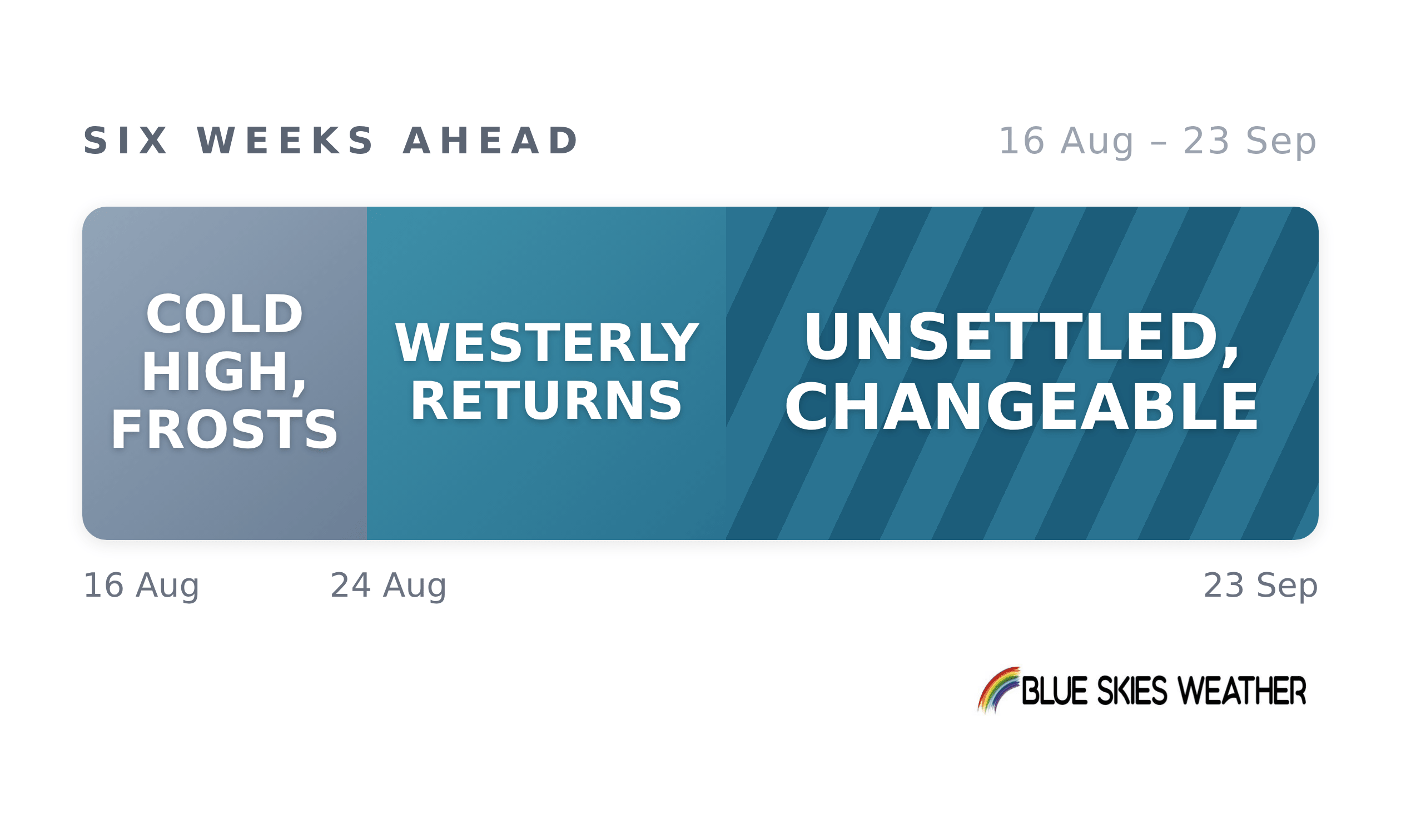
The week ahead brings the sharpest frosts of the season so far. A large, cold high will settle over the country from Monday and hold until about the 23rd. It will be sunny, still and very dry, with hard frosts on inland basins from the Waikato through to Central Otago, and rainfall well short of normal almost everywhere.
From about the 24th the westerlies return and stay for the rest of the outlook. That change is a firm one. What is less firm and more useful to know is that it does not settle into anything. Rather than one steady westerly spell, September looks like a run of fronts and ridges in quick succession. This is characterised by wet bursts on the West Coast and in the south, separated by short, bright, drier interludes, with a cold snap every week or so between them.
The east and north stay dry throughout and turn warmer and windier as the month goes on.
On the ground, that is two problems in sequence. The frost week checks pasture growth just as feed demand climbs, and it arrives on soils that have banked very little through August. Rain then returns from late August, but unevenly and mostly down the western side; the east and north carry their dry run right through to late September and will feel it as spring demand builds.
The changeable September also matters for anyone needing a settled run of days; the windows are there, but they are short.
Alpine and high-country areas will see snow in those cold snaps rather than the lowlands.
Tony joined us earlier this week on the show, watch the full chat here.
Blue Skies Weather issues full six-week outlooks for 13 regions every Tuesday. Read more here. CountryWide readers get 25% off here.
CountryWide CONNECT with Andy Thompson & Sarah Perriam-Lampp is our daily rural show livestreamed from 11am-1pm. Visit country-wide.co.nz on how to watch/listen or download the CountryWide CONNECT mobile app, available on Apple iOS and Android.