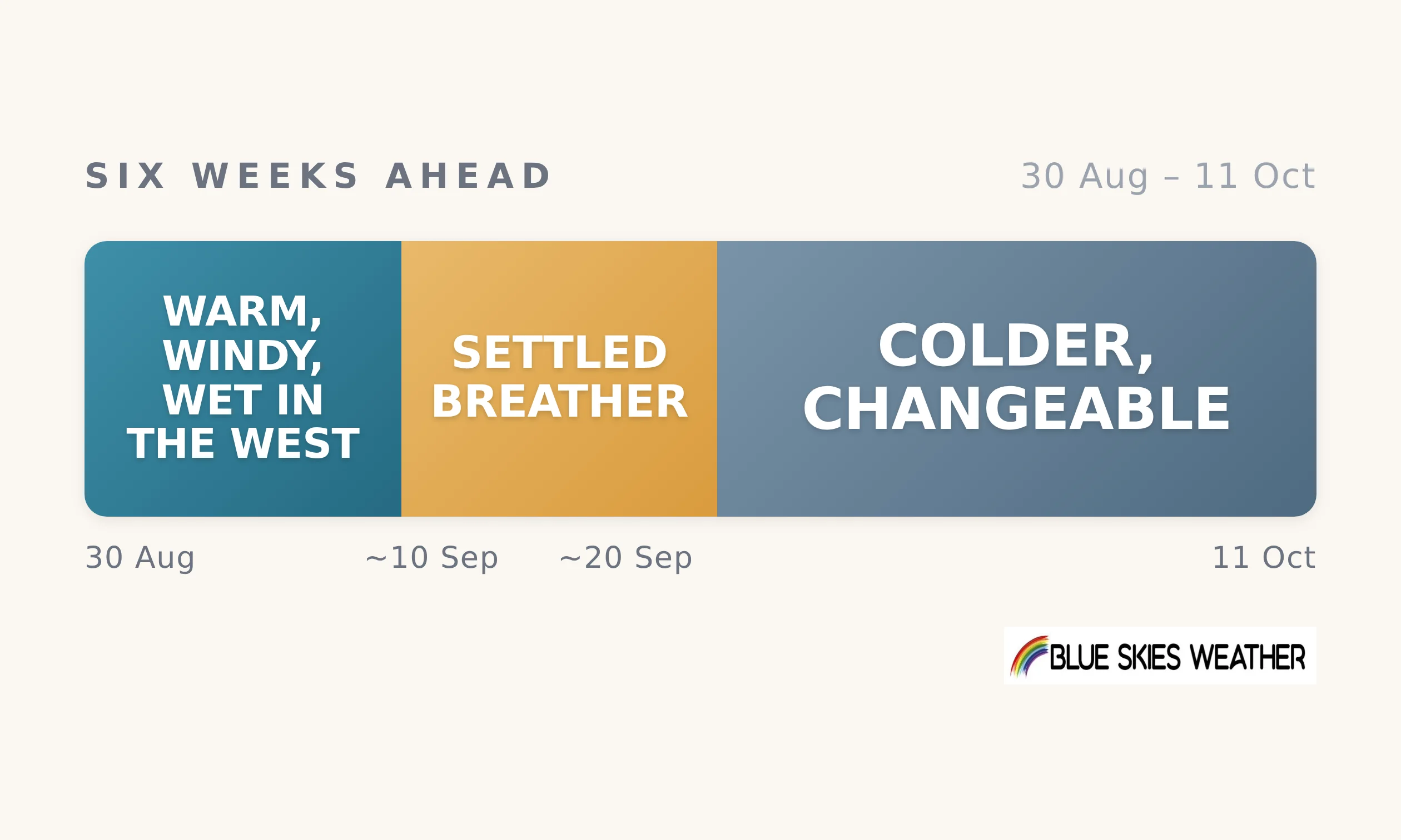
Spring has arrived in a hurry. The next six weeks open with a strong westerly across the country — the West Coast and Fiordland collect well over their usual rain into early September while the east of both islands runs warm, dry and windy, some of the warmest late-winter weather in years. That holds through next week.
Around the second week of September the pattern takes a breather: high pressure looks likely to settle over the country for about a week, calming the winds, drying the west out and bringing chillier nights inland. From around the 20th the outlook turns colder and more changeable, with a showery trough with a southerly flavour, the direction firmer than the dates before unsettled westerlies return into early October. Against a normal start to spring, this one is warmer, windier, drier in the north and east, and wetter in the west, but cooler later.
For farming, it is a friendly opening. Grass is moving early in the warmth, lambing weather in the east is about as good as it gets, and that settled mid-September spell offers a genuine window for groundwork — including on a West Coast that will need the drying time. The catch is the north: the North Island keeps missing the rain, and by early October most northern and eastern districts will be running 35 to 75 millimetres short, with soils drying faster than usual for the time of year. Southern and western catchments stay well watered, and the ranges keep building snow.
Watch Tony’s chat from earlier this week here.
Full six-week outlooks for 13 regions are issued every Tuesday. Read more here — CountryWide readers get 25% off here.
CountryWide CONNECT with Andy Thompson & Sarah Perriam-Lampp is our daily rural show livestreamed from 11am-1pm. Visit country-wide.co.nz on how to watch/listen or download the CountryWide CONNECT mobile app, available on Apple iOS and Android.