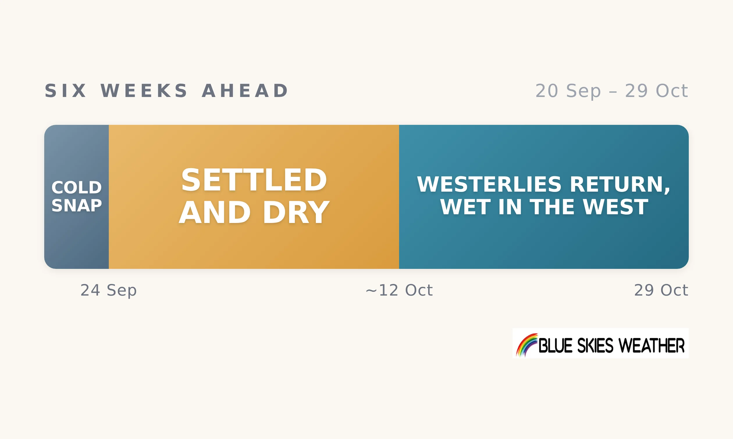
The next six weeks split three ways. The changeable run ends early this week with one last cold southerly, most likely Tuesday into Wednesday — cold enough for snow on South Island hill country, and a raw couple of days in the east of both islands. High pressure then moves in from the Tasman from about Thursday 24 September, and the two and a half weeks to about 11 October turn settled and dry almost everywhere, this time including the West Coast. Firm on the cold snap and the settled spell; likely on it holding into the second week of October. From about 12 October the westerlies pick up again, wet in the west and south, dry in the east — direction only at that range. Set against a normal late September into October, when spring westerlies are usually at their busiest, this is a quieter, drier stretch than usual.
For most farms the story is a drying one. After this week’s cold change there is little rain in sight for the north and east of both islands until at least mid-October, and moist soils must carry growth through a long dry run as water demand climbs. Growth should still be good while the moisture lasts, with mild, sunny days under the high. The nights are the catch: cold air left behind by the southerly, then clear calm skies, brings a few frosts to inland and sheltered areas late this week. Lambing and calving country in the south and east feels the Tuesday to Wednesday change most. The west and south get their rain back from mid-October.
CountryWide CONNECT with Andy Thompson & Sarah Perriam-Lampp is our daily rural show livestreamed from 11am-1pm. Visit country-wide.co.nz on how to watch/listen or download the CountryWide CONNECT mobile app, available on Apple iOS and Android.